- QGIS Download
- The Early Ottoman Peloponnese (Liakopoulos, 2019) Bookshop
- The Venetian Cadaster of Vostitsa (in Greek) (Dokos and Panagopoulos, 1993) WorldCat
- Greek Population Census of 27 October 1907 (2 volumes) (in Greek and French) ELSTAT
- Greek Agricultural Census of 1911 V. Peloponnese (2 volumes) (in Greek and French) ELSTAT
- ELSTAT Digital Library
The Helonaki Deep Dive 2.11
Vostitsa - Spatial Data
Release date: December 01, 2022

Description:
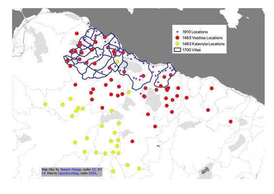
In this episode the spatial data associated with the 3 time periods under study (1463, 1700, and 1910) are discussed.
Show Links:
Disclosure: I am an affiliate of Bookshop.org and I will earn a commission if you click through and make a purchase from a Bookshop link.
Credits:
Theme music by Dan-O
Additional sounds from Zapsplat
The Helonaki Deep Dive is written and produced by Jen Glaubius of The Helonaki