The Helonaki Deep Dive

Explorations in mapping for historical and archaeological research.

Listen:

Support:

Become a Patron!

Playlists:

Ruth Shackelford's Diaries (1865 and 1868)

Vostitsa

Individual Episodes:
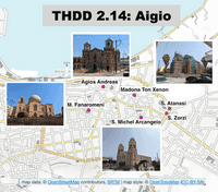
Map of Aigio with locations of 6 churches indicated and pictures of 4 of the churches.

THDD 2.14:

The town of Aigio/Vostitsa
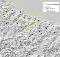
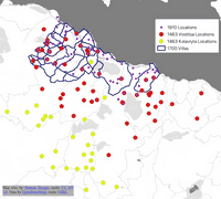
Map of northern Peloponnese with outline of Venetian Vostitsa villas (1700), and locations for 1463 Vostitsa, 1463 Kalavryta, and 1910 Vostitsa

THDD 2.13:

Locations in the Vostitsa Landscape
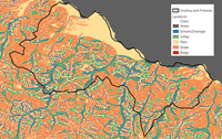
Map of northern Peloponnese with outline of Venetian Vostitsa villas (1700), and locations for 1463 Vostitsa, 1463 Kalavryta, and 1910 Vostitsa

THDD 2.12:

Vostitsa - Landscape

Map of northern Peloponnese with outline of Venetian Vostitsa villas (1700), and locations for 1463 Vostitsa, 1463 Kalavryta, and 1910 Vostitsa

THDD 2.11:

Vostitsa - Spatial Data

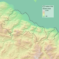
Map of terrain in northern Peloponnese with outline of Vostitsa territory in 1700.

THDD 2.10:

Vostitsa - The Data

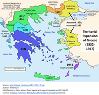
Map showing additions to Greece through time.

THDD 2.9:

Modern Greece

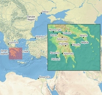
Map of Eastern Mediterranean and Black Seas with the locations of Istanbul, Odesa, Alexandria Egypt, Ioannina, Vostitsa, Patras, Kalavryta, Navarino, Methoni, Tripolis, Nauplio, Athens and Kalamata indicated.

THDD 2.8:

The Greek Revolution

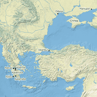
Map of Eastern Mediterranean and Black Seas with the locations of Istanbul, Crimea, Mariupol, Odesa, Vostitsa, Patras, Kalavryta, Pylos, and Kalamata indicated.

THDD 2.7:

Prelude to Revolution

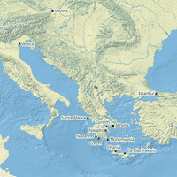
Map of Eastern Mediterranean Sea with the locations of Venice, Istanbul, Vienna,  Corinth, Coron, Monemvasia, Athens, Nauplio, Navarino, Santa Maura, Chania, and Candia/Irakleio indicated.

THDD 2.6:

The Venetians Are Back in Town
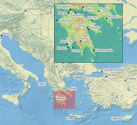
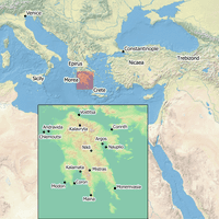
Map of Eastern Mediterranean Sea with an inset map of the Peloponnese with the locations of Venice, Constantinople, Vienna, Nicaea, Ankara, Corfu, Gallipoli, Cyprus, Crete, Corinth, Vostitsa, Patras, Modon, Coron, Mistra, Monemvasia, Delphi, Thebes, Athens, Naupaktos, Argos, Nauplio, Navarino, and Glarentza indicated.

THDD 2.5:

The Ottomans Get Involved

Map of Europe, the Middle East, and North Africa centered on the Mediterranean Sea with an inset map of the Peloponnese with the locations of Sicily, Venice, Constantinople, Crete, Corinth, Vostitsa, Patras, Modon, Coron, Mistra, Monemvasia, Nikli, Maina, Kalamata, Kalavryta, Andravida, and Chlemoutsi.

THDD 2.4:

The (Byzantine) Empire Strikes Back
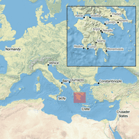
Map of Europe, the Middle East, and North Africa centered on the Mediterranean Sea with an inset map of the Peloponnese and Central Greece with the locations of Normandy, Sicily, Bari, Venice, Durrazzo, Constantinople, Crusader States, Crete, Thebes, Athens, Corinth, Vostitsa, Patras, Modon, Coron, Sparta, and Monemvasia.

THDD 2.3:

Venetians, Normans, and Franks
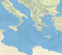
Map of the central Mediterranean centered on Greece with markers at Carthage, Rome, Patras, Aigio, Corinth, Thebes, Athens, and Constantinople.

THDD 2.2:

Byzantine Vostitsa

Map of terrain in northern Peloponnese with outline of Vostitsa territory in 1700.

THDD 2.1:

Introduction to Vostitsa

Turtle with map shell underwater.

THDD 2.0:

Season 2 Preview

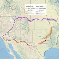
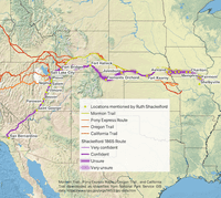
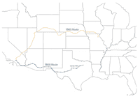
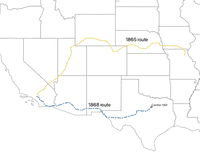
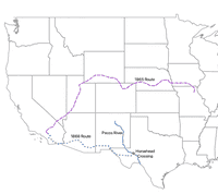
Map of the western United States with Shackelford 1865 route in purple and 1868 route in orange.

THDD 1.25:

1868 Map

Map of the western United States with Shackelford 1865 route in purple and 1868 route in orange.

THDD 1.24:

1865 Route

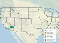
Map of the United States from Kentucky to California with various counties indicated.

THDD 1.23:

The Kirklands

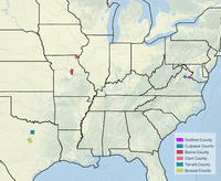
Map of the United States from East Coast to Texas with Culpeper and Stafford counties in Virginia, Boone and Clark Counties in Missouri, and Tarrant and Bosque counties in Texas indicated.

THDD 1.22:

The Rhyne Family

Map of the United States from East Coast to Texas with Culpeper and Stafford counties in Virginia, Boone and Clark Counties in Missouri, and Tarrant and Bosque counties in Texas indicated.

THDD 1.21:

The Gatewoods

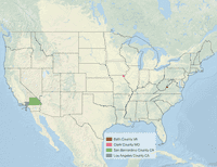
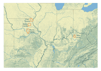
Map of the middle of the United States from Kentucky to Missouri with Scott Co., Kentucky and Boone, Shelby, and Clark Counties in Missouri outlined in blue.

THDD 1.20:

William Franklin Shackelford
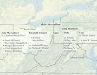
Map of the middle of the United States from Kentucky to Missouri with Scott Co., Kentucky and Boone, Shelby, and Clark Counties in Missouri outlined in blue.

THDD 1.19:

Family Trials

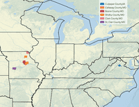
Map of the middle of the United States from Kentucky to Missouri with Scott Co., Kentucky and Boone, Shelby, and Clark Counties in Missouri outlined in blue.

THDD 1.18:

Ruth Galloway Shackelford

The Helonaki Deep Dive podcast cover image of a turtle swimming underwater with maps.

THDD 1.17:

Deep Mapping

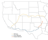
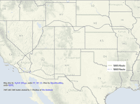
Map of the Western United States showing 1865 and 1868 routes for Shackelford family.

THDD 1.16:

End of the Road

Map of the Western United States showing 1865 and 1868 routes for Shackelford family.

THDD 1.15:

Mr. Gatewood

Map of the Western United States showing 1865 and 1868 routes for Shackelford family.

THDD 1.14:

Center Mills, TX

Map of the Western United States showing 1865 and 1868 routes for Shackelford family.

THDD 1.13:

Horsehead Crossing

Map of the Western United States showing 1865 and 1868 routes for Shackelford family.

THDD 1.12:

Barilla Station

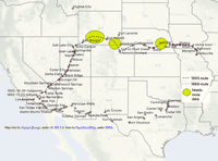
Map of the Western United States showing 1865 and 1868 locations where Shackelfords passed through and unclear portions of the routes.

THDD 1.11:

Apache Pass

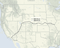
Map of the Western United States showing 1865 and 1868 Shackelford routes.

THDD 1.10:

Butterfield Overland Mail Route
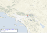
Map of southwestern United States with part of Shackelfords' 1868 route.

THDD 1.9:

On the Road Again

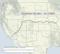
Map of Shackelfords' 1865 route.

THDD 1.8:

Ending, Beginning, and Middle

Turtle with map shell swimming underwater

THDD 1.7:

Sweet Freedom's Plains

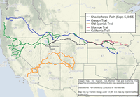
Oregon, California, Mormon trails across western United States.

THDD 1.6:

Trails

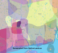
Indigenous territories around Manchester, CT.

THDD 1.5:

Indigenous Peoples, Pt 1

Screenshot of covered wagon floating river from game Oregon Trail.

THDD 1.4:

Oregon Trail

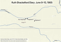
Map of the area near Fort Kearney along the Platte River with potential locations for Dogtown indicated.

THDD 1.3:

The Mystery of Dogtown and Doby
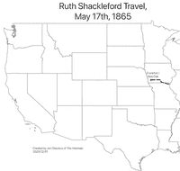
Map of the western United States with Frankfort and Red Oak, Iowa indicated.

THDD 1.2:

Which Stream Is It, Anyway?
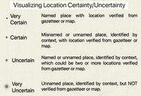
Map of the western United States with Clark County, Missouri and Icaria/Queen City, Iowa indicated.

THDD 1.1:

Setting Out

Turtle with map shell swimming underwater.

THDD 1.0:

The Helonaki Deep Dive Preview